The Cuvelai Basin covers an area of approximately 160,000 km², with 44% located in Angola and 56% in Namibia. Home to about 1.2 million people, it is characterized by extreme hydrological variability, experiencing frequent droughts and episodic floods, commonly referred to as “efundjas.” The Cuvelai is predominantly an ephemeral river system, with surface water only present for short periods during and after rainfall events. Despite the challenges, the basin supports livelihoods primarily through rainfed agriculture, groundwater extraction, and livestock farming.
The Cuvelai Basin is the most densely populated part of Namibia. This is a product of soils that are comparatively fertile and the ready availability of freshwater in shallow wells. While alluvial sediments make up substantial areas of the Central Drainage, Cuvelai Delta and the western Shana sub-basin zones, these are really only concentrated within the drainage channels themselves. These areas are very important to most people in the Cuvelai in providing fertile soils for crops.
Together with fresh water in shallow wells, it is these soils that attracted people to settle and farm here 500 to 600 years ago. Rainfed farming predominates with pearl millet (mahangu) the main subsistence cereal crop. Irrigation is limited to alongside the Kunene Transboundary Water Transfer Scheme canal between Olushanja Dam and Oshakati and the Etunda Agricultural project near Ruacana. Cattle are moved between dry winter season grazing grounds and wet season areas around the homes of their owners.
The winter grazing grounds were always in areas where few people lived but this system is increasingly under threat because wintering grounds have been lost, or the grazing available per unit animal has been severely reduced (Mendelsohn, 2015). Many of the grazing areas have been expropriated by fenced farms for the exclusive use of individual cattle owners.
The Kunene River Basin, spanning about 106,500 km², is primarily located in Angola (87%), with the remainder in Namibia. The basin’s population of approximately 2.38 million people relies on the Kunene River, which originates in Angola’s central highlands and flows through diverse topographies before reaching the Atlantic Ocean. The Kunene Basin holds significant potential for hydropower irrigation though currently underdeveloped.
The Kunene River rises in the central highlands of Angola at elevations of up to 2000m near the town of Huambo. This area, the “planalto”, receives relatively high amounts of rainfall (1000 to 1500 mm), and is one of the continent’s “water towers”, hosting the headwaters of other important rivers such as the Kuanza, Queve and Kubango. The area has become a densely populated agricultural area. The Upper Kunene is characterised by highlands with gentle rolling hills separated by broad shallow valleys in the central Angolan highlands. The Middle Kunene consists of rolling hills, whilst the Lower Kunene exhibits mountainous topography and semi-arid to arid conditions. Near the river mouth, the river crosses the Namib desert.
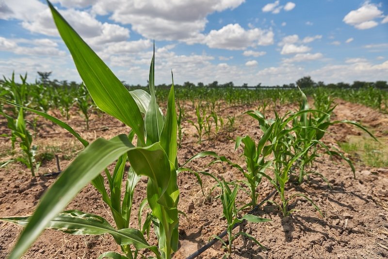
In the Upper Kunene, the dominant crops are maize and beans and to a lesser extent sweet potato, with livestock playing a complementary role in local farming systems, being used for animal traction and as a source of milk. In the Middle Kunene, which is mostly semi-arid, farming systems are generally based on livestock as well as crops with a greater range of crops (maize, manioc, sorghum, millet and cowpea being grown. The semi-arid and arid lower section of the Kunene is dominated by subsistence pastoralism, supplemented by crop cultivation on the Kunene Riverbank and around springs during the rainy season.
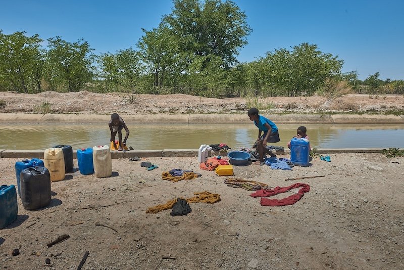
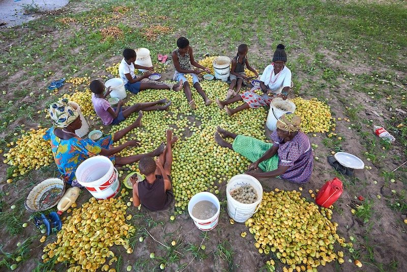
Subsistence livelihoods are complemented by the collection of firewood, the production and sale of charcoal, the gathering, consumption and sale of natural food and medicinal plants, the hunting of wild animals, as well as artisanal inland fisheries in rivers and lakes.